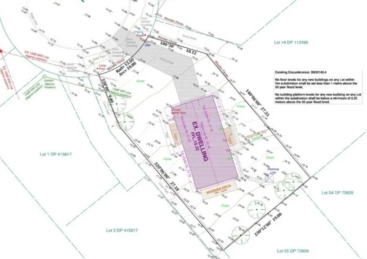
Topographic Surveys
A topographic survey plan is a detailed, scaled representation of the natural and man-made features of a specific area of land. It is commonly used in construction, engineering, and land developments to provide essential information about a site’s surface characteristics.